
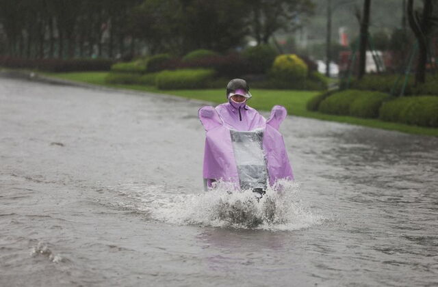
China floods Hebei Liaoning Typhoon Bavi northern provinces 2026 has produced the most severe flooding in northern China this year, with Typhoon Bavi, described as the most powerful storm to strike mainland China in 2026, driving water levels above two metres on roads in Kuancheng county in Hebei province, sweeping away vehicles, stranding approximately 1,800 villagers, and triggering red flood alerts across Liaoning province while the storm's reach extended across six provinces including Jilin, Shandong, Jiangsu, and Anhui, where China's Ministry of Water Resources confirmed 46 rivers nationwide are experiencing flooding above warning levels. Social media footage circulating on RedNote showed residents of Shenyang in Liaoning swimming backstroke down flooded roads where only the roofs of parked cars were visible above the waterline, with another clip showing a person standing on a paddleboard to navigate neighbourhood streets that the floodwaters had transformed into navigable waterways, creating the specific visual documentation of urban inundation at a scale that local authorities' red alert declaration and Hebei province's mandatory work stoppages and business closures were designed to prevent through early action but could not fully contain against the storm's intensity. Several cars in Kuancheng were filmed crashing into each other as they bobbed on a waterlogged road before being carried away by the current's force, capturing in seconds the specific physical consequence of water levels that overwhelm road drainage systems and transform urban streets into river channels whose current exceeds what standard motor vehicles can resist.
"During a red alert for heavy rain, all work stoppages, business closures, and gatherings must be fully implemented," Hebei authorities stated in a WeChat announcement, activating the specific emergency protocol framework that Chinese provincial authorities deploy when meteorological conditions reach the threshold whose operational consequence is the mandatory cessation of normal economic and social activity in favour of protective measures whose implementation the alert level legally requires.
The flooding's geographic scope, spreading across Hebei, Liaoning, Jilin, Shandong, Jiangsu, and Anhui as authorities had warned, documents Typhoon Bavi's reach well beyond the coastal provinces that typically absorb the initial impact of Pacific typhoons making landfall on China's eastern coast, with the storm's remnant moisture systems carrying the precipitation inland in a pattern that China's Central Meteorological Observatory tracked and broadcast through CCTV warnings about thunderstorms, hailstorms, and tornado-generating conditions in areas extending from the northeast through the Yangtze River basin provinces. The combination of Typhoon Bavi's direct precipitation with the flood risk exacerbated in areas already soaked by earlier downpours creates the specific compound flood event whose severity exceeds what the typhoon's rainfall alone would have produced on dry antecedent soil conditions, making the 46 rivers at or above warning levels the quantified expression of a soil moisture saturation situation that the new precipitation has pushed into active flood emergency across multiple river systems simultaneously.
Prime Minister authorities' statement that relocating and resettling residents was their top priority reflects the specific emergency management hierarchy in which human life protection through evacuation and temporary shelter provision precedes the infrastructure damage assessment and utility restoration that the post-flood recovery phase requires, with the 1,800 stranded villagers in Kuancheng being the specific population whose safe extraction represents the most urgent operational objective of the Monday response.
How Typhoon Bavi Created the Conditions for China's Most Severe 2026 Flood Event
Typhoon Bavi's designation as the most powerful storm to strike mainland China this year establishes its meteorological significance in the 2026 Pacific typhoon season whose development has been tracked by Chinese and international meteorological agencies through the formation, intensification, and landfall sequence that brought it to the eastern coast with the wind speeds and rainfall intensity that distinguish a significant weather event from the routine tropical cyclone activity that China's coastal provinces experience through the summer months. The storm's impact on densely populated eastern cities through violent winds and heavy rain created the immediate coastal emergency whose inland extension through the moisture systems that typhoon remnants carry produced the Hebei and Liaoning flooding that the social media footage from Kuancheng and Shenyang most dramatically documents. China's Central Meteorological Observatory's warning of Force 11 winds reaching up to 117 kilometres per hour and tornado-generating conditions in central and northern Jiangsu documents the meteorological severity that extended well beyond the typhoon's coastal landfall zone into the inland provinces where the storm's moisture energy found the atmospheric instability that produced the severe convective events the observatory warned about.
The railway system disruption, with more than 30 sections affected and Shenyang trains suspended according to China Railway's Monday announcement, creates the specific transportation infrastructure consequence that large-scale flooding produces in densely networked rail systems where track flooding, embankment saturation, and bridge stress monitoring all trigger precautionary service suspensions that protect passengers and rolling stock from the flood-related derailment and infrastructure damage risks that operating through high-water conditions creates. School closures across Jilin and other affected areas reflect the same precautionary logic applied to the child safety context, where the combination of street flooding that creates dangerous conditions for student travel, building safety concerns in structures exposed to heavy rainfall, and the staffing challenges that emergency conditions create for educational institutions produces the school closure decision that authorities across multiple provinces have implemented as a protective measure rather than as a reflection of direct school building damage.
The antecedent moisture conditions that the Typhoon Bavi warning specifically identified as an exacerbating factor, with areas already soaked by earlier downpours facing heightened flood risk from the new precipitation, document the compound event dynamic that makes some flood emergencies more severe than their immediate precipitation trigger alone would produce. Soil saturation reduces the infiltration capacity that normally absorbs a significant portion of rainfall before it becomes surface runoff, meaning that the same amount of precipitation produces substantially more flood volume when it falls on saturated soil than when it falls on dry ground, explaining why the provinces that had already experienced heavy rainfall before Bavi's arrival were specifically flagged by authorities as facing elevated risk from the additional precipitation rather than being expected to absorb it within their river systems' normal capacity.
The 46 Rivers Warning Level and What It Means for Downstream Communities
China's Ministry of Water Resources confirmation through CCTV that 46 rivers nationwide are experiencing flooding above warning levels is the quantified expression of a water system under simultaneous stress across multiple river basins whose geographic distribution across six provinces documents the spatial scale of the current flood emergency. Warning level flooding in Chinese river management terminology indicates that water levels have reached the specific gauge height at which flood prevention authorities activate heightened monitoring, prepare flood control infrastructure for potential emergency operation, and begin pre-positioning evacuation and emergency response resources in the communities downstream of the monitoring stations where warning levels have been triggered. The transition from warning level to danger level to guarantee level flooding in China's flood alert system represents the progressive worsening that authorities are managing in real time across 46 rivers simultaneously, with each river's specific catchment characteristics, channel capacity, flood control infrastructure condition, and downstream population exposure creating the individual risk profile whose management contributes to the aggregate national flood emergency picture.
The Kuancheng flooding's specific water level measurement of more than two metres above road surface provides the concrete scale reference that transforms the general flood severity language into the tangible physical reality that explains why cars were swept away and 1,800 villagers became stranded rather than evacuating before the water reached dangerous levels. Two metres of water above road surface exceeds the vehicle flood depth at which standard passenger cars become buoyant and lose traction control, the depth at which adults risk losing their footing in moving water, and the depth at which single-storey structures begin to experience significant inundation whose residents require elevation or external rescue rather than self-evacuation through the flooded environment. The resident account broadcast by local official media providing the two-metre measurement gives the flooding's scale the specific firsthand credibility whose communication through official media channels validates the emergency response justification.
The Red Alert Response, Transportation Shutdown, and What the Coming Days Require
Hebei province's mandatory work stoppage and business closure order issued under the red alert for heavy rain represents China's most operationally significant administrative emergency response to extreme weather, reflecting the specific authority that provincial governments hold under China's emergency management law framework to order the cessation of economic activity whose continuation in severe weather conditions creates preventable risk to workers, customers, and transportation users who would otherwise be exposed to the hazardous conditions the red alert designates. The implementation of this authority through a WeChat announcement reflects the specific communication channel that Chinese authorities have integrated into their emergency communication infrastructure, recognising that the social media platform's penetration across the population whose behaviour the alert is designed to modify makes it among the most effective real-time emergency communication tools available alongside the conventional broadcast media and mobile alert systems that accompany major weather emergencies.
The railway suspensions affecting more than 30 sections and the specific Shenyang service halt represent the transportation system's protective response to flood conditions that make normal rail operations both unsafe for passengers and damaging to infrastructure whose long-term integrity requires the precautionary suspension of service until water levels recede and track inspection can confirm the structural condition that safe operation requires. China's rail network density in the northeastern provinces means that service suspensions on multiple sections create cascading disruptions whose magnitude in terms of passenger journeys affected, freight movement delays, and economic activity interruption extends well beyond the physical geography of the flooded sections themselves, with connecting services, long-distance trains, and the supply chains that depend on rail freight all experiencing the systemic impact that concentrated section closures produce in networked transportation systems.
The Central Meteorological Observatory's warning of Force 10 and above thunderstorm winds in central and northern Jiangsu, with maximum winds potentially reaching Force 11 at 117 kilometres per hour and possible tornado formation, creates the additional weather hazard dimension that the current emergency extends beyond flooding into the wind and severe convective weather category whose management requires different protective responses from the flood evacuation that the Hebei and Liaoning situations have been prioritising. Tornado risk warnings in populated Chinese provinces are not routine occurrences, and their inclusion in the observatory's current alert package documents the meteorological severity of the convective instability that Typhoon Bavi's moisture interaction with the atmospheric conditions over China's eastern provinces has created, with the potential for isolated tornado touchdown events adding the most extreme localised wind damage risk to a province already managing the flooding that the storm's precipitation has produced in the northern provinces.